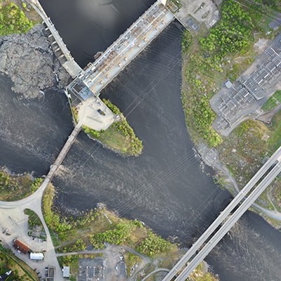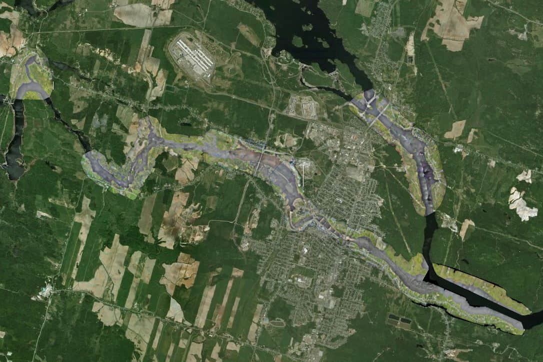
Photogrammetry surveys of the Saguenay river shoreline for the city of Alma
During a six-day survey, Can-Explore logged over 20 hours of flight time and travelled 436 linear kilometres to gather topographical information to update the city of Alma’s database. With this information, Alma can more efficiently manage the Saguenay river’s water level by comparing it with that of Lac-Saint-Jean.