fbpx

3D Scanning

LiDAR Scanning

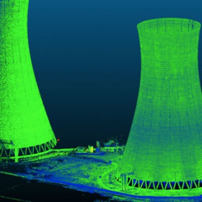
3D scanning (terrestrial LiDAR) makes it possible to get geometric details of various elements that can serve various purposes, for instance inspecting or taking precise measurements, such as an area, a volume or vector length between two points. Using a drone and 3D scanner, among other things, enable us to accurately model various types of structures for different purposes, such as our deformation and verticality assessments.

Accurate data collection

Modelling of various structures

State-of-the-art technology

As high precision geometry, 3D scanning offers many benefits. We use it, among other things, for:

  • Accurate measurements everywhere;
  • Creation of as-built plans;
  • Pre-manufacturing of elements to add to the structure;
  • 3D modelling (deformation and verticality assessments);
  • Monitoring.

réseau d’aqueduc

Deformation Assessment

A deformation assessment is a complementary study to get a more accurate diagnosis for a structure. Monitoring deformations help evaluate, among other things, the impact of temperature variations on an asset (change in season, a temporary overload applied to a structure, vibrations close to a structure being studies, and construction defects. Our deformation assessment requires the use of specialized tools, such as a high-precision total station, a micrometer and a crack measurement device.

réseau d’aqueduc

Verticality Assessment

A verticality assessment consists in studying the position of a structure compared to a normal plane or any other known plane in order to identify deficiencies. It is complementary to the deformation assessment and supports a diagnosis. 

With its expertise in geomatics and civil, water, software and mechanical engineering, Can-Explore’s team is able to conduct these assessments on all types of structures.

réseau d’aqueduc

Projects

Any questions? A specific project in mind?

Don’t hesitate to contact us. Our solutions are tailored to your needs.

Call Now Button