

Whether you are a property owner, developer, broker, notary, or architect, our legal surveying services are essential for optimizing the management of spaces and infrastructure, ensuring the legal compliance of transactions, and preventing property disputes on private, provincial, or federal lands.
With our customized solutions and expertise, you can be confident that every aspect of your real estate projects will be accurately documented, securing your investments and facilitating compliance with applicable norms and regulations.
Legal surveying operations must be carried out by a land surveyor and are defined in Section 34 of the Land Surveyors Act.
Legal surveying for your sector:
Services for the Building Sector — New Constructions:
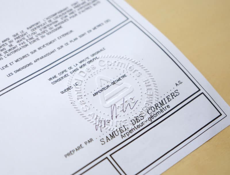
Certificate of Location
Provides a clear understanding of property boundaries and existing constraints, optimizing land development and supporting construction project planning. This certificate is mandatory for property transactions (submitted to the notary) and confirms compliance before any construction or development. It is also valuable for mortgage refinancing and resolving property disputes.
Land Expertise
Resolves property disputes, determines land value, and supports pre-acquisition analyses. Includes a comprehensive report with legal, technical, and physical information gathered by our licensed surveyors.
Property Line Survey Certificate (Staking Certificate)
Establishes precise property boundaries before construction begins. Boundaries are physically marked on-site with stakes or rods to minimize disputes with adjacent owners and ensure compliance with building permit requirements.
Cadastral and Subdivision Operations
Involves modifying or creating official property representations in the cadastral registry. This service is critical for dividing properties into multiple parcels, whether for residential or commercial purposes.
Legal Boundary Survey (Bounding)
Resolves disputes or uncertainties regarding property boundaries. This process is conducted under the authority of a licensed land surveyor and governed by the Civil Code of Quebec.
Technical Description
Provides detailed plans and reports that outline land boundaries, features, and dimensions. These descriptions ensure compliance with zoning regulations and offer accuracy for notarial deeds, subdivisions, and land transactions.
Leased Space Certification (Rental Space Certificate)
Supports property owners in managing leased spaces and ensuring compliance with lease agreements. Includes detailed plans and reports specifying the dimensions, areas, and easements of leased spaces.
Spatial Planning
Supports real estate developers and property owners by providing strategic guidance for the efficient and sustainable use of land. This service includes land use analysis, zoning compliance planning, and the optimal arrangement of structures to maximize property value and functionality. It ensures that projects align with environmental, regulatory, and community requirements, making it essential for urban planning and large-scale real estate developments.
Topographic Plan and Leveling
Supports land assessment and development planning for residential or commercial projects by identifying critical terrain features, such as flood zones, topography, wooded areas, and watercourses.
Construction Placement and Compliance Services – Existing Buildings:
Placement Project and Placement Certificate
Certifies the precise location of a structure in relation to property boundaries, a requirement for construction permit applications. Construction points are marked on the ground using iron rods to ensure compliance with zoning and land use standards.
Layout Plan and Layout Certificate
Combines planning and physical marking of future building locations. These services guide construction and ensure alignment with approved plans, land use regulations, and zoning requirements.
Implementation Certificate
Confirms that construction work has been completed in accordance with approved designs, zoning regulations, and building codes. This certificate is often required before final inspections or advancing to subsequent construction phases.
When Might You Need a Land Surveyor?
Obtain a Recent Certificate of Location for a Real Estate Transaction
Before buying or selling a property, an up-to-date certificate of location ensures that everything is in order: building locations, easement compliance, and absence of land disputes.
Plan Real Estate Development Projects
Whether you’re considering a new residential neighborhood, a shopping center, or an industrial park, we create topographic plans and cadastral documents to bring your projects to life. Our placement certificates also ensure that your projects comply with municipal regulations and zoning standards.
Check the Status of Land in a Flood Zone
Before purchasing or developing land, our analyses help you avoid unpleasant surprises by confirming whether it’s located in a risk area.
Divide or Expand Land to Optimize Its Potential
If you wish to sell a large plot in several parcels, we handle the necessary cadastral operations to create compliant lots ready for marketing.
Sell or Refinance a Property
Whether you own a commercial or residential building, our plans and legal documents streamline your sale or refinancing process.
Evaluate the Exact Boundaries of Land Before a Purchase
Are you considering purchasing a property? Our services confirm its precise dimensions and prevent potential disputes.
Create a Condominium or Subdivide a Building into Multiple Units
We prepare the necessary plans to transform an existing building into a condominium or multiple separate units.
Establish Easements for a Real Estate Project
Need access for roads, footpaths, or infrastructure? We define and formalize the necessary easements for your projects.
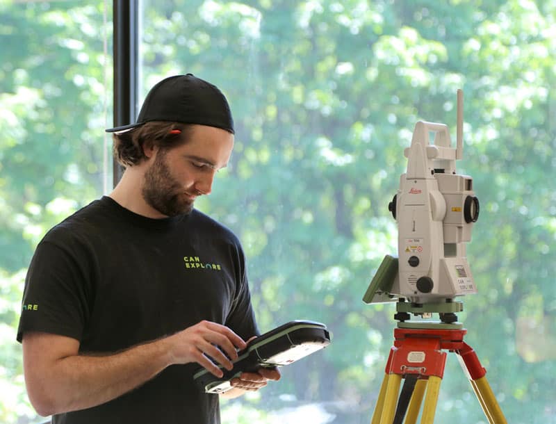
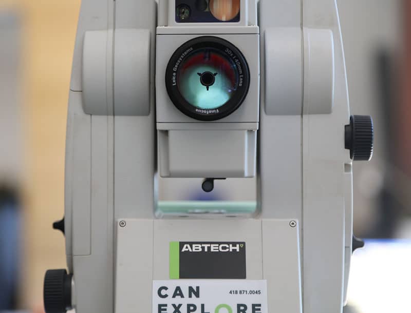
Services State-of-the-art tools
Land surveyors master a wide range of technological tools, enabling them to achieve greater speed, precision, and efficiency:
- Global Navigation Satellite Systems (GNSS), which can determine positions anywhere on the earth’s surface.
- Total stations, which measure both angles and distances.
- LiDAR-type laser scanners, which take billions of measurements over a study area and project them in a 3-D environment.
- Drones that provide high-resolution aerial imagery.


Our specialized surveying tools
WingtraOne GEN II by Wingtra
The WingtraOne GEN II is a cutting-edge, intelligent mapping drone that offers unparalleled performance for surveying large sites (photogrammetry). This drone maximizes coverage in a single flight, covering up to 460 hectares in one hour, optimizing surveying operations by minimizing labor hours. With its VTOL (vertical takeoff and landing) design, it excels particularly on vegetation-free terrain. The WingtraOne GEN II is equipped with a 61 MP camera, ensuring the highest quality images with an absolute horizontal accuracy of less than one centimeter. Its advanced GNSS PPK technology ultimately eliminates the need for ground control points, further reducing on-site preparation time.
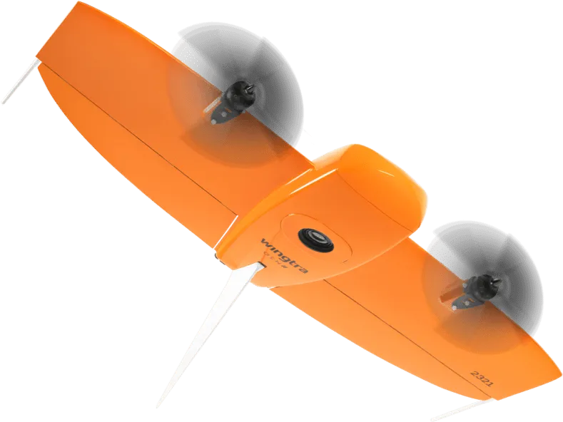
Image courtesy of Wingtra.
Pegasus TRK 700 Neo by Leica
The Pegasus TRK 700 Neo by Leica is a cutting-edge mobile mapping tool capable of capturing over one million LiDAR scans per second. Equipped with artificial intelligence, it is the ideal tool for quickly surveying long road segments. By integrating SLAM (Simultaneous Localization and Mapping) and RTK (Real Time Kinematics) positioning precision, this device references geospatial data with centimeter-level accuracy. Its integrated ISOFIX cameras capture ultra-high-resolution images, enabling detailed 3D visualization of point clouds collected by its LiDAR scanner.
Image courtesy of Leica Geosystems.
NavVis MLX by NavVis
The NavVis MLX revolutionizes 3D reality capture with its advanced handheld technology. Its compact and ergonomic design provides unlimited mobility for surveyors, making it perfect for scanning confined, complex, and hard-to-reach spaces. Featuring a 32-layer LiDAR sensor paired with SLAM (Simultaneous Localization and Mapping) software, this system ensures the highest point cloud quality among comparable tools. Additionally, its four integrated cameras capture high-resolution 360º images, enabling exceptional 3D visualization of the collected data.
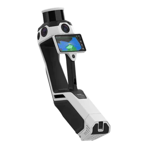
Image courtesy of NavVis.
Request a quote: Land surveyor services
Any questions?
Don’t hesitate to contact us. Our solutions are tailored to your needs.