

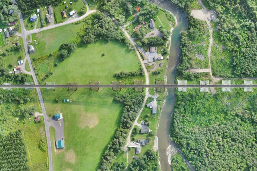
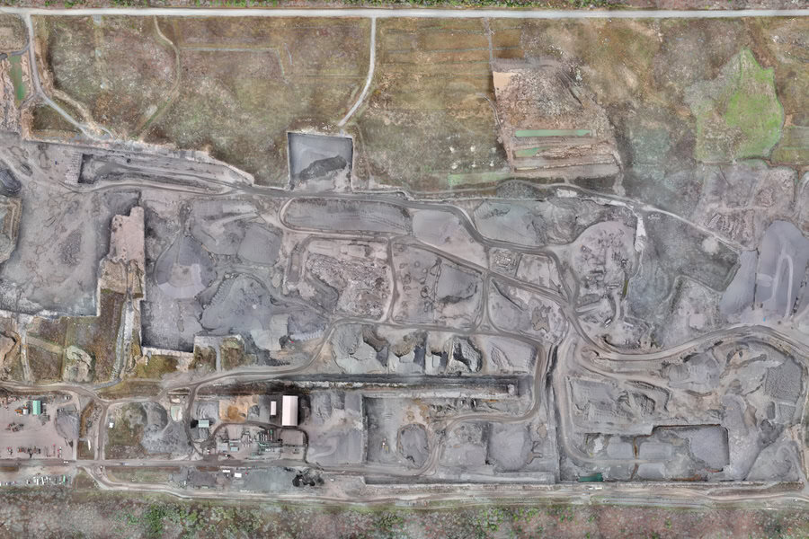
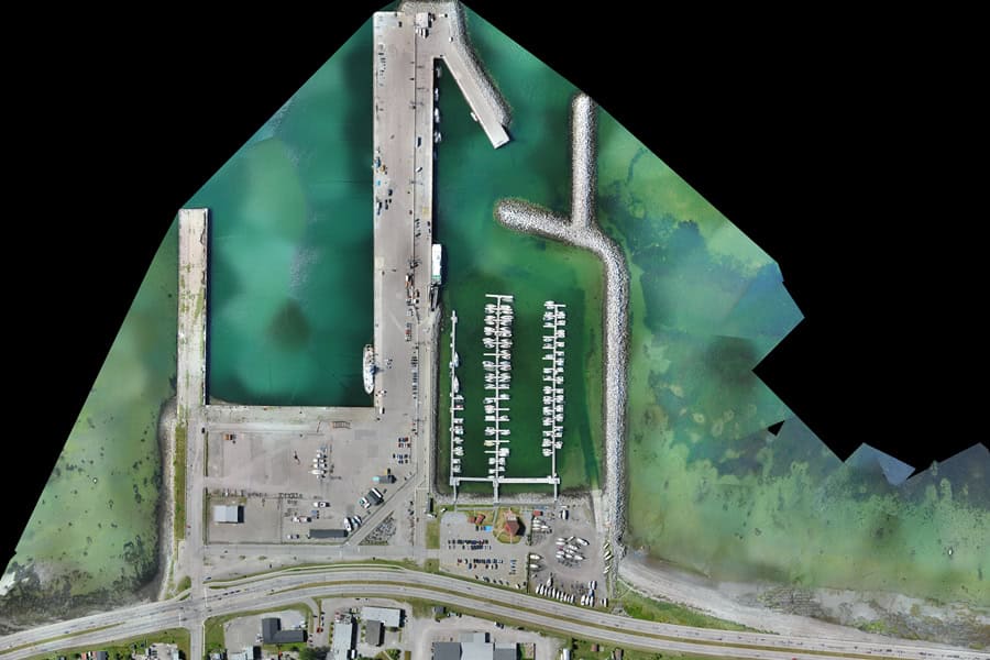
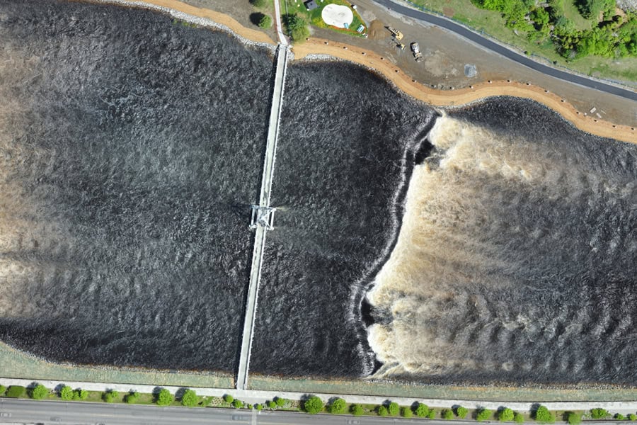
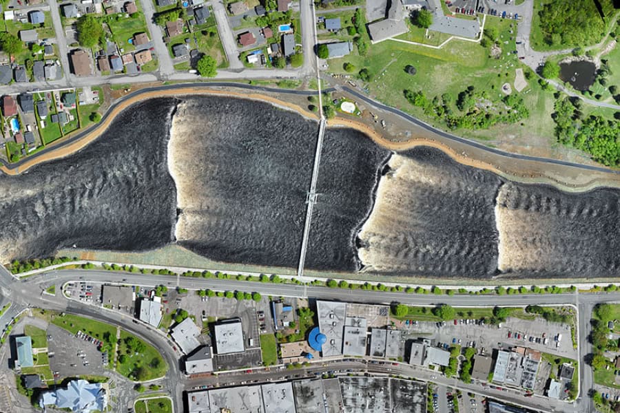
Orthophotos (or orthomosaics) are high-resolution, georeferenced aerial images that offer a scaled representation of a terrain and its visible infrastructures. They are an essential tool in surveying, providing a precise and detailed overview of a terrain, aiding in the identification of property boundaries and easements, and allowing for better project planning and plan updates.
Can-Explore leverages its specialized tools and expertise in orthophotography to support urban planning and land management professionals. With our high-resolution aerial surveys, we assist municipalities, urban planners, and land managers in quickly obtaining data for the development, planning, and monitoring of their projects.
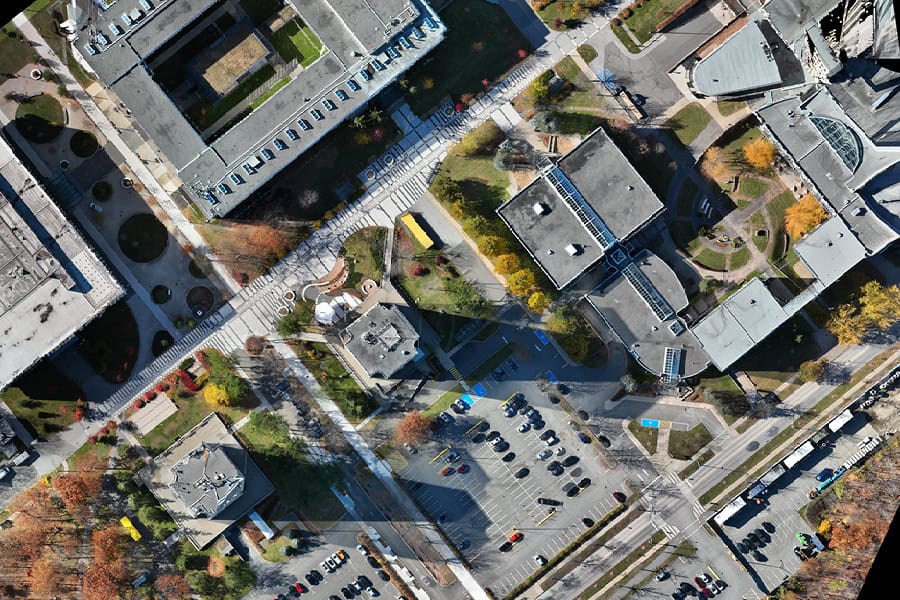
Applications of Orthophotos in Urban Planning
Orthophotos offer a multitude of applications for urban planning and land management professionals:
- Site monitoring
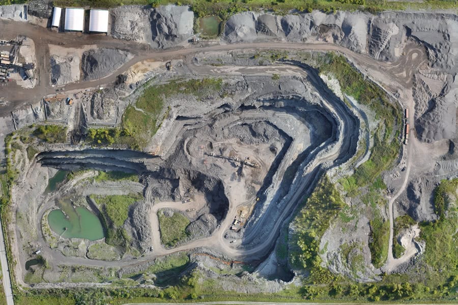
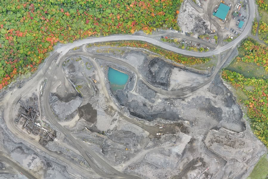
Periodic tracking of construction progress from start to finish. Orthophotos enable visual assessment of work progress, helping to detect potential issues and make informed decisions to ensure compliance, and adherence to timelines and budgets. - Land management – Cadastral plans
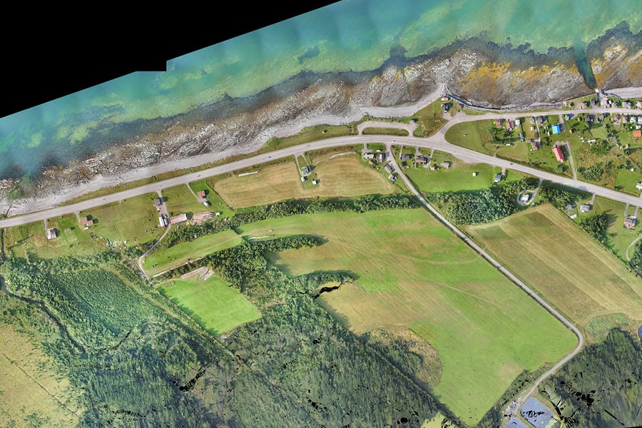
Orthophotos are a valuable tool for long-term land management, facilitating the updating of cadastral plans, monitoring changes, identifying risk areas (floods, landslides), and more.
- Project presentation
Use of orthophotos for presenting development or urban planning projects to officials, citizens, or investors. Orthophotos provide the ability to visualize projects in their real context, facilitating understanding and communication. - Mapping and GIS
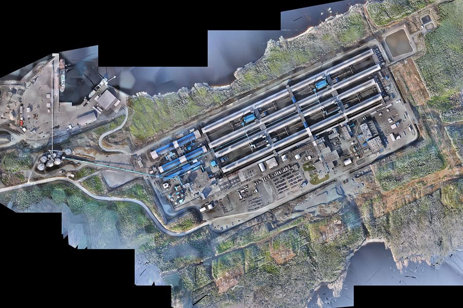
Orthophotos are an essential data source for creating accurate topographic maps, integrating into Geographic Information Systems (GIS) for spatial analysis, and for land modeling. - Environmental assessment
Orthophotos are a valuable tool for visualizing environmental changes to analyze the impact of development projects: monitoring the restoration of contaminated sites, deforestation, shoreline erosion, etc..
Our specialized surveying tools
WingtraOne GEN II by Wingtra
The WingtraOne GEN II is an intelligent, state-of-the-art mapping drone that delivers unmatched performance for surveying large sites (photogrammetry). This drone maximizes coverage in a single flight, capable of covering up to 460 hectares in one hour, optimizing surveying operations by minimizing labor hours. With its VTOL (Vertical Take-Off and Landing) design, it excels particularly on terrain without vegetation. The WingtraOne GEN II is equipped with a 61 MP camera, ensuring the highest quality images with absolute horizontal accuracy of less than one centimeter. Its advanced GNSS PPK technology eliminates the need for ground control points, further reducing on-site preparation time.
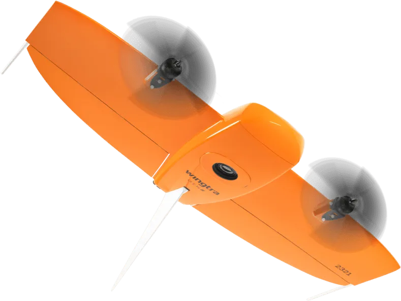
Picture from Wingtra.
Matrice 300 RTK by DJI
The Matrice 300 RTK is a versatile quadcopter drone known for its modularity. This drone offers the flexibility to easily change the type of sensor installed, making it ideal for various types of surveying and inspection projects. Available options include the DJI Zenmuse L2 LiDAR scanner for detailed photogrammetry, the 45 MP DJI ZENMUSE P1 camera ideal for capturing high-resolution orthophotos, or the XT2 Zenmuse DJI thermal camera, perfect for thermographic inspections.
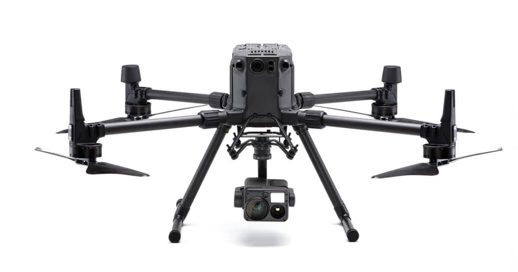
Picture from DJI.
Quick quote request: orthophotos
Any questions?
Feel free to contact us. Our solutions are tailored to your needs.